
Summer of Glass
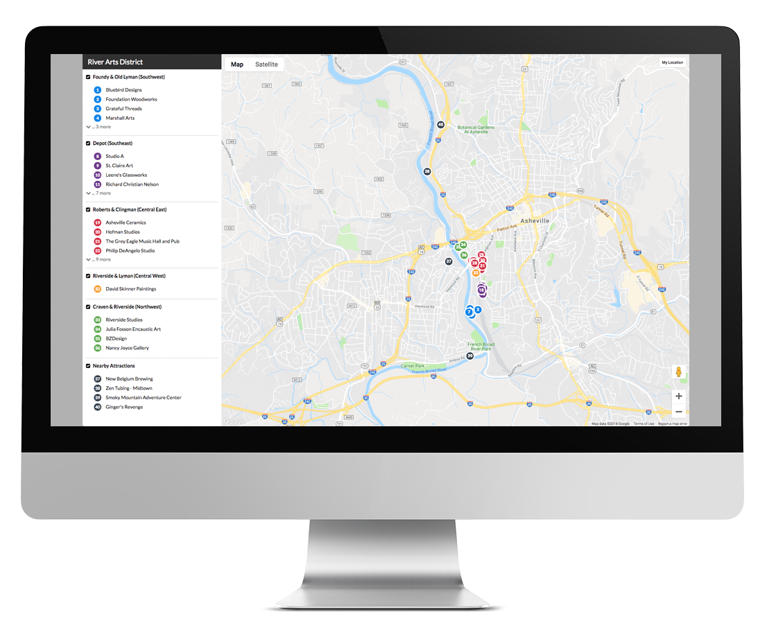
Elizabeth White, Web Manager at Explore Asheville Convention & Visitors Bureau and her team rolled out interactive maps across some key pages of ExploreAsheville.com, with plans to roll out more in the future. Their Map Publisher maps are featured on a blog post, “Take a Glass Art Day Trip;” a landing page for the River Arts District; and a microsite page, Summer of Glass. The Summer of Glass microsite promotes a glass art initiative, and was created to take advantage of the buzz surrounding the Chihuly exhibit at the Biltmore.®
The microsite calls attention to local galleries, museums, art studios, and tours where visitors can see glass art, with maps illustrating where each is located. Elizabeth was even able to bring campaign branding into the digital maps by using initiative brand colors, different from their main branding hues, for the 62 plot points and in the map keys.
“We liked that Map Publisher works with Google Maps, an interface most people know and use already,” said Elizabeth. “We liked the print feature and the ability to display listing feeds as map points,” she noted, referring to the fact that Map Publisher can pull existing listings from your CRM into the maps you build. “You can not only pull listings, but add map points not in your CRM, so you can edit and customize your maps,” said Elizabeth.
The Right Tool for the Job
Elizabeth finds the Map Publisher tool easy to use. “It’s the same interface that we’re used to already. If you use the (Simpleview) CMS and pull listings, it’s the same, very user-friendly.” Elizabeth goes on to say "Summer of Glass has been really successful,” noting that 2/3 of the partner participants in the campaign were not working with the DMO prior to the initiative.

Elizabeth built her own interactive maps using the tool and integrated them with her destination website content while giving us great feedback to help us improve the release.
Mapping Out Future Opportunities
The maps Elizabeth created for the microsite, meanwhile, enhance web content, inform interested visitors and locals, and guide them to local artists and business partners. “We noticed that a lot of visitors are on mobile, so we like that (Map Publisher maps) work well on mobile,” she added. The option to view maps on mobile phones makes them a useful tool for in-market visitors and even locals, whenever they want to access directions to an art studio, hours of operation, or contact information.
Despite their initial interest in the printed map option available to Map Publisher users (Map Publisher allows users to print high-quality print maps of various sizes with QR codes that link to interactive maps), the DMO hasn’t had the need for them yet, though Elizabeth can already picture some future potential. She’s considering exporting the Summer of Glass map as a pdf for visitors to download.
Explore Asheville doesn’t run a Visitor Center, so she saw no need for a printed version right away, but she can envision printing full-page sized maps for their printed travel guide, she said, possibly showing the top 10 local landmarks and featuring a QR code.
For now, she’s planning to roll out more interactive maps on informational web pages, showing where to park and pulling in listings to parking garages, for instance. She’d also like to add them to neighborhood pages on the site.
The DMO doesn’t just promote the city of Asheville, but also all of Buncombe County, including nearby neighborhoods and towns. “On our neighborhood pages, we already feature content pulling in listings (through the CMS), so we’re planning on adding maps,” Elizabeth said.
Discover the ultimate solution for creating interactive maps
Use maps to boost website content, support marketing campaigns, and assist visitors and partners.
Lead the way to Map Publisher